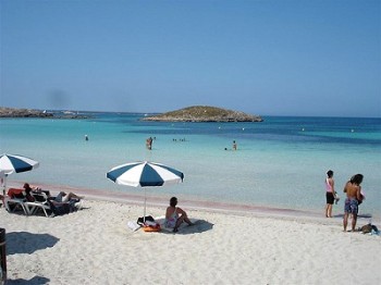
Espalmador
 Continuing to proceed to the north of Ses Illetes beach, soon you will reach the tip of the peninsula of Trucador, which coincides with the northern end of Formentera.
This point, called Es Pas also known as “The Crossing” (crossing), and ‘partial islet s’Espalmador connected by a strip of sand about 200 feet long.
This stretch can be covered using a boat that sails from the port of Cala Savina or other small boats from Ses Illetes, or, for those who are well trained, by swimming.
On days when the weather is particularly favorable, the journey can be accomplished even on foot because the sea level does not exceed the meter, especially in the morning at low tide.
S’Espalmador is a wild and uninhabited island of just 3 square kilometers, completely lacking any kind of structure, given the abundance of plant and animal species from which it is populated, in fact, considered a protected natural park, which is subject the absolute prohibition of building bars, restaurants and more.
So remember to bring water, food and everything that can serve you.
This place, on the other hand, many small hidden natural wonders.
There are several beaches, all virgins and beautiful, but it is certainly the most beautiful S’Alga beach (or Racó), a natural bay with white sand and Caribbean sea, a favorite destination for many tourists during high season, can see many (and loud) yacht stationed off the coast of this beautiful cove.
At the center of the islet, near the S’Alga beach, sulfur is a small lagoon where you can enjoy healthy hot baths of clay, which seems to do much good for the skin.
The only structure built by human hand is to the west, the highest point of s’Espalmador: this is Sa Guardiola Tower, a watchtower built in the eighteenth century, which is proposed as an interesting vantage point of the whole area .
Map of Espalmador
Tags: platja de ses Illetes, s'alga, sa guardiola tower, ses illetas


